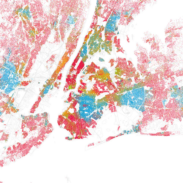
How segregated is your city? Check out these maps made byEric Fisher. Based on data from the 2000 census, these maps of 40 U.S. cities use dots to represent people to try to minimize generalizations [although he does collapse the census’s [somewhat dubious to begin with] categories into 5 broader ones.]
Find your city; you might be shocked at how easy it is to locate streets, universities, and other landmarks based on race alone. Here’s New York.


